Showing posts with label germany. Show all posts
Tuesday, July 15, 2014

Ideas for long distance cycling in Europe

EV-Routes

The initiative of the ECF (European Cycling Federation) to connect bicycle routes across Europe seemed like a very good idea, but fails due to a lack of work being done in a timely manner. If you open the website of EuroVelo, you can look at the routes through Europe. Let me tell you that it looks really amazing. Criss-cross through the continent on a bike. Wow!

Open this URL.

Bikemap euro long distance
Look at this map! Isn't it great to live in Europe?

"Not realised" or "Planned"; what does it mean?

After clicking on EuroVelo Route 4 symbol, I ended up on another screen thereupon that showed me a disappointing sight. Notice how everything is either not realised or planned. I'd estimate 15 % of the entire route being realised. The worst thing is that I know that parts of EV4 actually have good bicycle paths. A cyclist on my Google+ page informed me through a comment that it was a shame that I did not take the route from Köln to Koblenz, as it is quite beautiful. Just to inform you: I came through the Eifel region in stead of Köln, but a cyclist recommending this route means that it is in a good state. Another part that I know of is the route from Wiesbaden/Mainz to Frankfurt. I have actually cycled this track and the path was really, really nice. I thoroughly enjoyed this route - with the exception of the pinch flat before reaching Frankfurt.
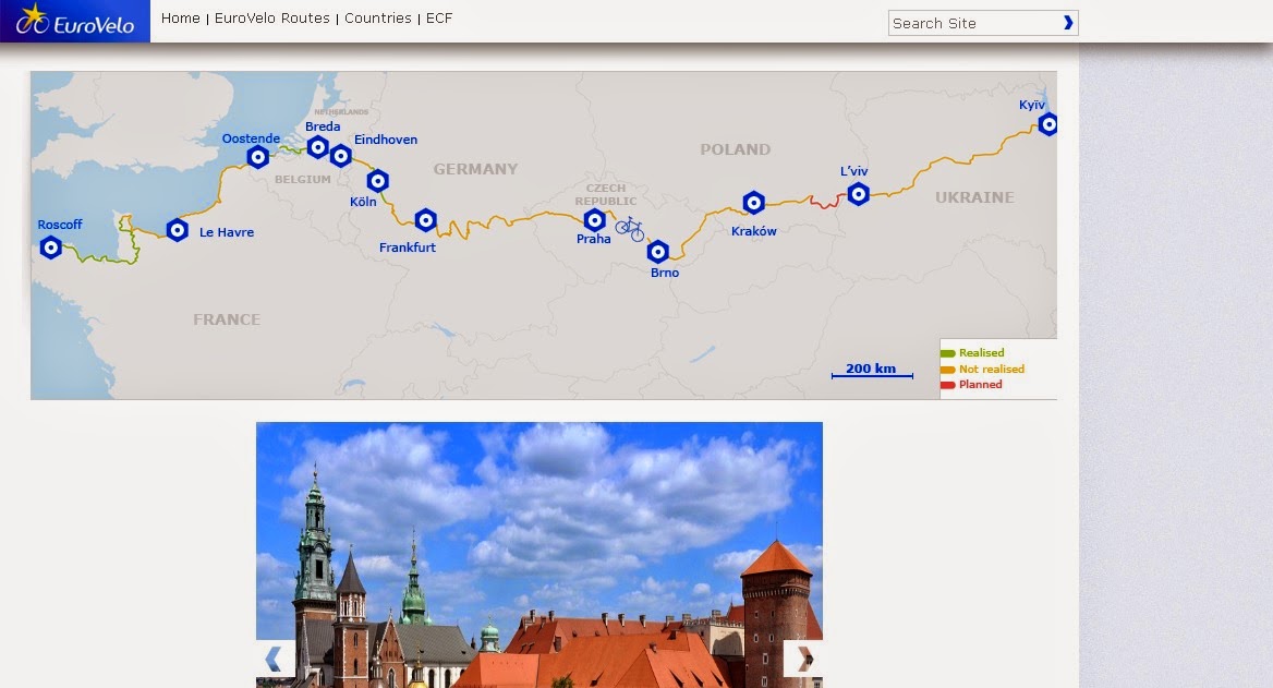
ECF EuroVelo outdated
Why do they even have this on their website? You have a route from Oostende to Breda or Eindhoven and a path along the French coast. That makes up a really small portion of the actual route. A lot of routes have cycling lanes and local sign posts. Why is it not realised?

biking through europe cycling map
A few days ago, I looked up this track and know for sure that there is a bicycle route here. It is called the 'Donauradweg'. It goes from Regensburg to Vienna and even further. I have no idea why that is not realised as of now.
I can only explain the lack of routes being realised because:
  1. There are bike paths but ECF never tested these tracks.
  2. Maybe some bureaucrats are stalling the process.
  3. The website is outdated.
  4. Nobody cares about these paths. People will still cycle long distances using national sources.

Alternatives and solutions

Alternatives to planning a long distance tour using the EV-Routes

Alternatives to the EV-routes are unfortunately on a national level. The countries where I've used the resources with regards to long distance cycling have only been available in the native language. This means that I'd either have to use a translation service or guess my way through the site. Sometimes there were alternatives for tourists but these sites were altered slightly (eg. no long distance routes and route planning tool provided).

I am currently making tutorials for planning a cycling route through a specific country. At this point, I've only made the tutorials for Germany, Austria and the Netherlands. I'll make more in the future.

Solutions on a European scale

Things need to be changed to let the EV-routes become as good as they look.

What I think needs to be done:
  1. The EV routes have to be realised in full.
  2. Data of all EU nations relating to bicycle paths have to be gathered
  3. Using this data, it is possible to update the map of EuroVelo and realise the routes
  4. Ofcourse these routes have to be cycled and signs have to be put up
  5. The EV routes have to be reviewed and tested as well. Bikers who take these routes must have a place to give feedback. If there actually was a forum on http://www.eurovelo.org/forums/, it would be possible to give feedback/suggestions.
  6. After realising the EV map and putting up the signs along all routes, I think it is a good idea to make a route-planner on a European level (much like the Dutch site).
Let me explain some of the points made. The stretches of unrealised route HAVE actual bicycle paths. If there are paths, then the only thing missing would be a sign, some approval or the update on the website. Why would that drain so much sources?

The second point speaks for itself. Should the ECF have the data with regards to the bicycle paths of all countries (where EV runs through), realising these routes should be easy. These EV routes have to be cycled by actual cyclists and there should be a possibility to give feedback to ECF.

The last point made deserves some extra attention. Please open the following website: http://www.nederlandfietsland.nl/fietsrouteplanner . It is super detailed bicycle map with a neat function: you can find routes from and to any point in the Netherlands. I know what you are thinking: "on a European level this would be ridiculous." That is certainly true but what if the route planning tool on supranational level only evaluates long distance routes? It would make it possible to make a trip from London to Vienna even though there is no EV route going there.

Look at the picture and you will understand:
EuroVelo Routeplanner
The distance here is really incredible. You'll need a lot of time to cover this route.

Anyway, it would be nice to be able to combine various EV-routes through a route planning tool. You can also add functions like estimated time, distance, altitude, calories burned, etc.

If you have some good alternatives, feel free to contact me. I will put em on my site.

UPDATE CLICK HERE TO READ MORE. Good ECF alternative found.

Tuesday, June 24, 2014

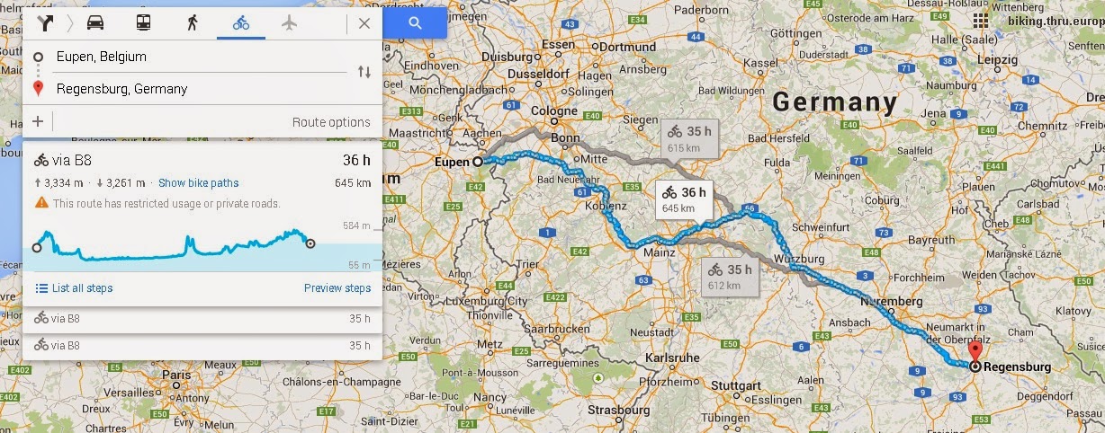
Goal: From Eupen to Regensburg

Time to seperate the boys from the men. If 80 km is possible in one day (I could have gone further to be honest), then it is also possible to spread 645 km over a week or so. The thing I noticed today, is that even though it was exhaustive, I do not have sore muscles today. I feel quite fit. There is just one thing that bothers me today, and that is that I've forgotten to put sunlotion on yesterday. Oh well...


Biking through Europe

The plan is to:
  1. take my bike on the train to my mother in Belgium.
  2. I'll stay there and spend some time with my mom.
  3. Subsequently I will take the train to Eupen.
  4. After arrival, I will depart on my bike in Eupen with Regensburg as the ultimate goal.
  5. As I am a spontaneous kind of guy, I will not plan beforehand where I will rest and sleep.
  6. I will document the whole trip with pictures, videos and a log.
  7. My experiences will be shared with the world on this blog, as it might be useful to people who are also interested in biking through Europe.
  8. IF there are problems on my way to Regensburg, I COULD take the train to Regensburg. However, I can only come up with a few unlikely reasons why I would do that. A sprained ankle, an accident or another unexpected occurance one can't foretell.

Sometime next week, I will travel to Belgium between Sunday the 29th of June 2014 and Tuesday the 1st of July 2014 [edit] Monday the 30th of June. I am already very exciting about this and I will equip myself necessary utensils. I'll buy my ticket today, after I've done some research with regards to the cheapest and best ticket (bicycle on train, best price, etc.). Edit: I will have to negotiate a good time to travel with my girlfriend. We are invited to a birthday party and it would be cool, if I could stay long enough to party before departing to Belgium. It will still be Sunday or Monday.

Note: as you can see from the crossed text, I am quite flexible. Never make plans you cannot change!

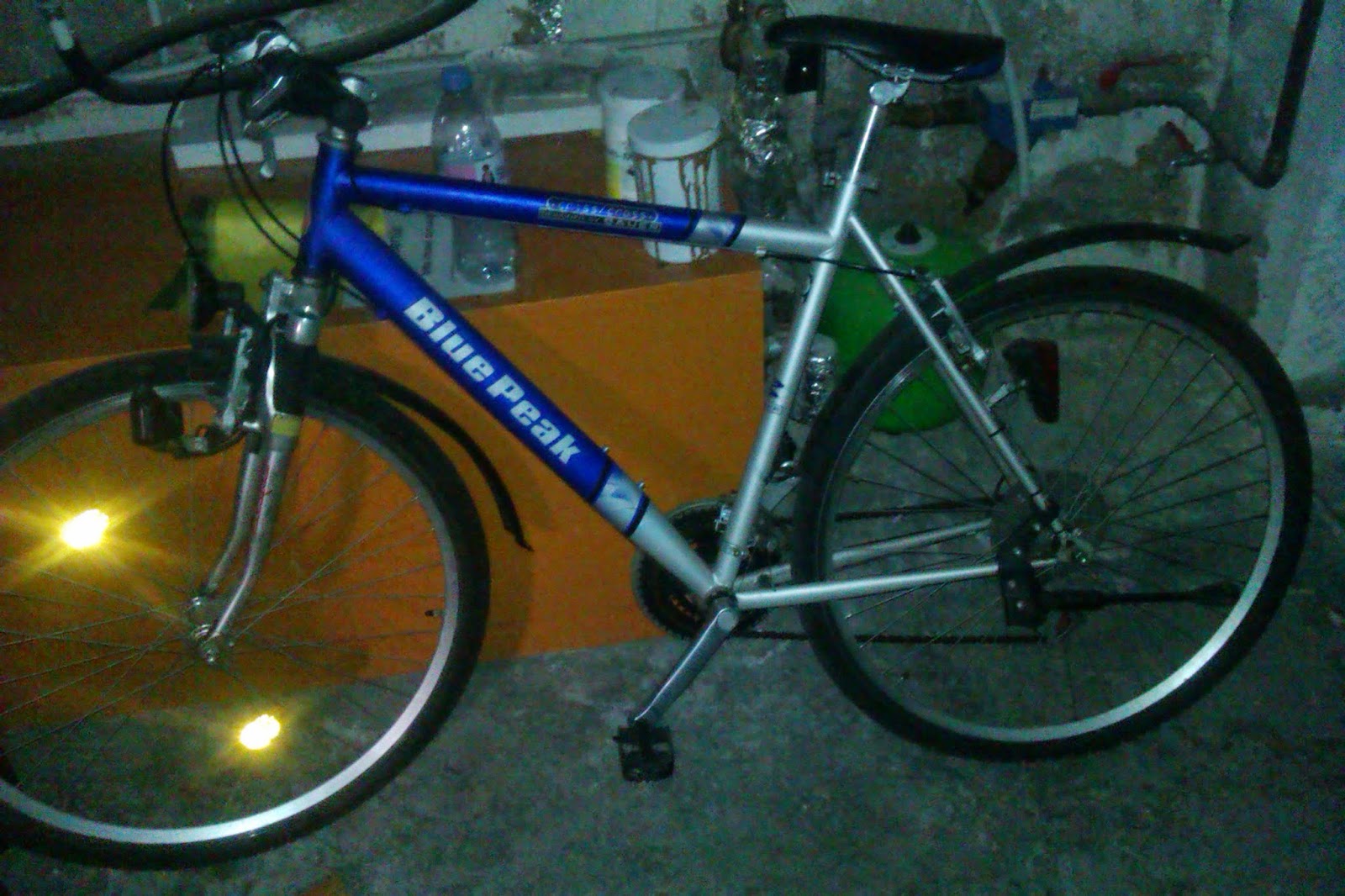
I've also made a picture of my bicycle, as it might be interesting for you to see my gear. I do not really care about a good bike. The important thing is that the bike is sturdy and comfortable.

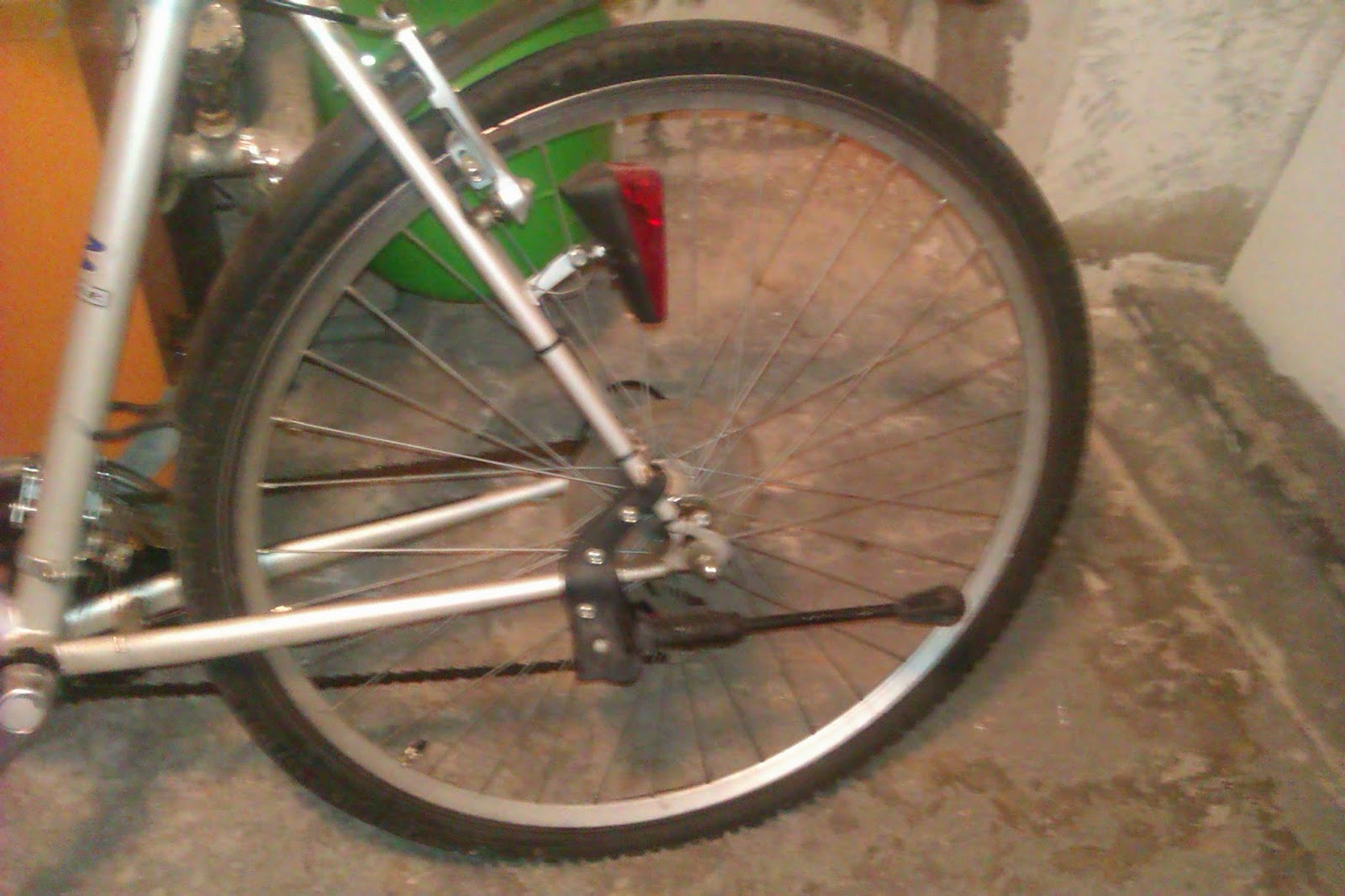
Hole in biketire
As you can see, I have a flat tire. I will fix it today.

cycle gear low quality spirit is what counts
This bike actually looks quite good on this picture. It is quite bad though in comparison to the real cyclists' bikes.

The difference between me and 'real' cyclists is that I am not wearing a helmet, nor do I have special clothing, gear (reflectors EVERYWHERE, odometer, heart rate monitor, etc.) or other things that are totally redundant. Yesterday, I wore a jeans with a normal t-shirt and it did not bother me at all. I would have preferred trainers, yet I did not have them in Eschenbach. I find it ridiculous to think that this special gear is needed to ride a bike. The Germans, from what I can tell, are really taking cycling too serious. "Oh, you can't ride a bike without a helmet. That is waaaay too dangerous." or "Wearing special clothing makes me go faster and makes me look like a pro-biker." or "Aren't you having X brand? Are you tired of living? What if the wheel suddenly dislocates while you are going 20 km/h?". Do not forget that reflexes have to be trained. I think that too much (or any) protection also gives a false sense of security. While being overly protective on a bike, it is possible for these people to drive 230 km/h on the 'Autobahn' while talking on the cellphone.

My point being: the thing that is needed to be safe on a bike is COMMON SENSE. Just be cautious in the way you cycle and you'll be fine. Ofcourse there are fools on the road and even though you are cautious, other people who aren't can be a danger to you. But isn't this danger the same for all traffic participants?

Common sense also means that, if you are going downhill from a mountain and forest with sharp rocks, trees and other objects, a helmet and additional protection do make sense. I have no problem with protection but there is a discussion going on in Germany about bikers being obligated to wear a helmet.

Nuff said. I'll fix my bike tube now and buy a ticket for next week. You'll be kept up to date.

Cheers mates.

From Eschenbach i.d. Oberpfalz to Schwandorf

Going on an unprepared trip through Bavaria

I've spent a night in Eschenbach i.d. Oberpfalz and, for reasons unknown, I have decided to take a bike of a friend and cycle all the way home the next day. There wasn't really anything that needed to be done today, so I've given in to the impulse and got on the bike. The route "From Eschenbach i.d. Oberpfalz to Schwandorf" was more or less a spontaneous trip without much preparation.

80 km is the biggest trip I've taken up until now. Using the pictures I have made on my way to Schwandorf, I can explain the route I have taken. Neither the quality nor the quantity of pictures was optimal. The sole purpose of these pictures was for me to remember the trip, as I easily forget details to a story.

For my next trip, which I have already planned, I will put more focus on pictures and I will write more about the route itself. The long-term plan is to map good routes, to make recommendations for cyclists (hostels, hotels, restaurants and sight-seeing spots) and to take notes of the routes I am taking.

Radfahren von Eschenbach nach Schwandorf
This was the route I've taken. I am not sure if this was the exact route, but it is a good estimation.
Radweg von Eschenbach nach Schwarzenbach
This is a picture I've taken on my way from Eschenbach to Weiden.

Radweg vorbei Schiesslweiher in Schwarzenbach
This picture was taken while biking passed the 'Schießlweiher'. The German word 'weiher' means pond.
Radfahren in Schwarzenbach
Schießlweiher in Schwarzenbach.

Fahrradweg zwischen Schwarzenbach und Weiden
Somewhere between Schwarzenbach and Weiden...

Rost lenker altes Fahrrad
I do not have a nice bike, as you can see from the rust on the handlebar. Then again, people who assume that one needs expensive and high quality gear to ride a bike over long distances are taking things too seriously.

Radweg nach weiden durch den Wald
A cycling road between Schwarzenbach and Weiden. Right through the forrest with some small changes in altitude.

Radfahren Bundesstrasse
Here you can see that the path leads next to the 'Bundesstraße'. A Bundesstraße is a road with a 100 km/h speedlimit. Cyclists are allowed to cycle there as well, even though it is quite dangerous.

DETOUR: if you are cycling over Weiden, you are making a detour as I did. To plan this tour without a detour, please take a look at the bottom of the page. I have made a quick tutorial for a different route.

Bike lane from Rothenstadt to Luhe and Luhe-Wildenau
This is somewhere between Weiden and Luhe. I am not sure where it is but I am guessing that it is in 'Rothenstadt'.

Bayern Radfahrweg langweilig
Landscape.  Boring.

Die Straße von Luhe nach Wernberg
If I am not mistaken, this is on the way from Luhe to Wernberg-Köblitz. 10 minutes after taking this picture, I've gotten a flat tire. Had to walk for half an hour until I've found a farm, where I have asked the farmer if he had something to inflate my tires. Fortunately he did.

radfahrweg naabtal Oberköblitz
On this picture, I have found the beautiful 'Naabtalradweg'. Naab is a small river, tal means 'valley' and Radweg means cycleway. I am guessing that this is Oberköblitz. Not sure though.

Unterköblitz weg neben Naab
I can tell from this picture that I was on the right side of the Naab. That means that this would probably be 'Unterköblitz'.

Radfahrweg von Unterköblitz nach Iffelsdorf
Between Unterköblitz and Iffelsdorf.

Naabtalradweg asphalt straßenpflaster
This is pretty much proof of how awesome the Naabtalradweg is. The road is not always like this. Sometimes it is a dirt road, sometimes it is pavement like this and sometimes it is old asphalt.

German climate soil and vegetation
What kind of shock would it be for a Syrian refugee to be looking upon this green paradise.Walking or cycling for hours passed so much vertile land.

village of potheads unfunny
The sign says "Iffelsdorf".

Mais in Deutschland
A field like any other. I guess that is corn, right?

Natur in Nabburg fast da
I am almost in Nabburg.

Einen Storch, dass mit einen Bulldog gekämpft hat
A stork. No idea why this was so interesting at the time. The stork was picking a fight with a tractor (which was left of the stork and not visible on this picture).

schlimmer-arsch-storch
Bad ass stork doing his thing.

Schild von Nab burg
Entering Nabburg. My tire has almost deflated once more and I was already close to riding on the rim. This made it clear that I would not reach Regensburg without fixing my tire.

Nabburg schaut echt schön aus
Doesn't Nabburg look nice?

Radfahren durch Stulln
After inflating for the second time, I was biking towards Stulln.

Schlechteste Fotograf in Deutschland
The road. As you can tell, I have a knack when it comes to taking pictures.

Fast in Stulln
I already see the Stulln sign. Woohoo.

Bayen fahrrad
Getting closer...

Stulln schild
And I've reached Stulln.

Gasthof Bodenstein in Stulln
This is a Gasthof in Stulln. The people here gave me directions and let me use their bicycle pump. It was really needed, as it was deflated for the third time.

Gasthof Bodensteiner in Stulln is ideal for cyclists
Because of the friendly people here, I'll give them some publicity.

Zimmer Bodensteiner bier radler freundlich
They offer rooms and a cold beer (or Radler, which is beer with lemonade). The people are nice and this stop is perfect for cyclists. I was really in a hurry because my bicycle tube was running out of air in short intervals. That being said, I have not taken any pictures of the following villages I have passed: Grafenricht, Schwarzenfeld, Irrenlohe and Richt. I have asked a farmer in Richt once more if he got a tool to inflate my bicycle tube. 

Biking in Schwandorf, Ettmansdorf, krondorf and Richt
Even though it was only 4,6 km, I did not reach the destination without fully deflating my tube.

Familie Holler Schwandorf
The sign says: "Fischgarten Schwandorf".

Es gibt auch Büsse von Richt Schwandorf
I think this is from Richt to Schwandorf.

Schandorf Nature road
Almost there...

Zug Schwandorf Regensburg
I have finally reached the trainstation and I took the train to Regensburg.

Zug Schild Schwandorf
I would have cycled all the way to Regensburg, if it wasn't for the bike giving up on me.

DETOUR INFORMATION (not cycling via Weiden)

For people cycling over Grafenwöhr (US army base), Freihung and Amberg, I'd recommend taking another route. I'll explain step by step how you can take this detour:

Step 1: open google maps to find a good estimation

To learn more about using google maps and planning an estimation of a cycling trip, visit this page.
You should take note of the cities you'll pass: Grafenwöhr, Hütten, Kaltenbrunn, Freihung, Größschönbrunn, Ammersricht, Amberg, Kümmersbruck, Lengenfeld, Theuern, Ensdorf, Rieden, Vilshofen, Schmidmühlen, and so forth.

Step 2: look for actual bicycle paths

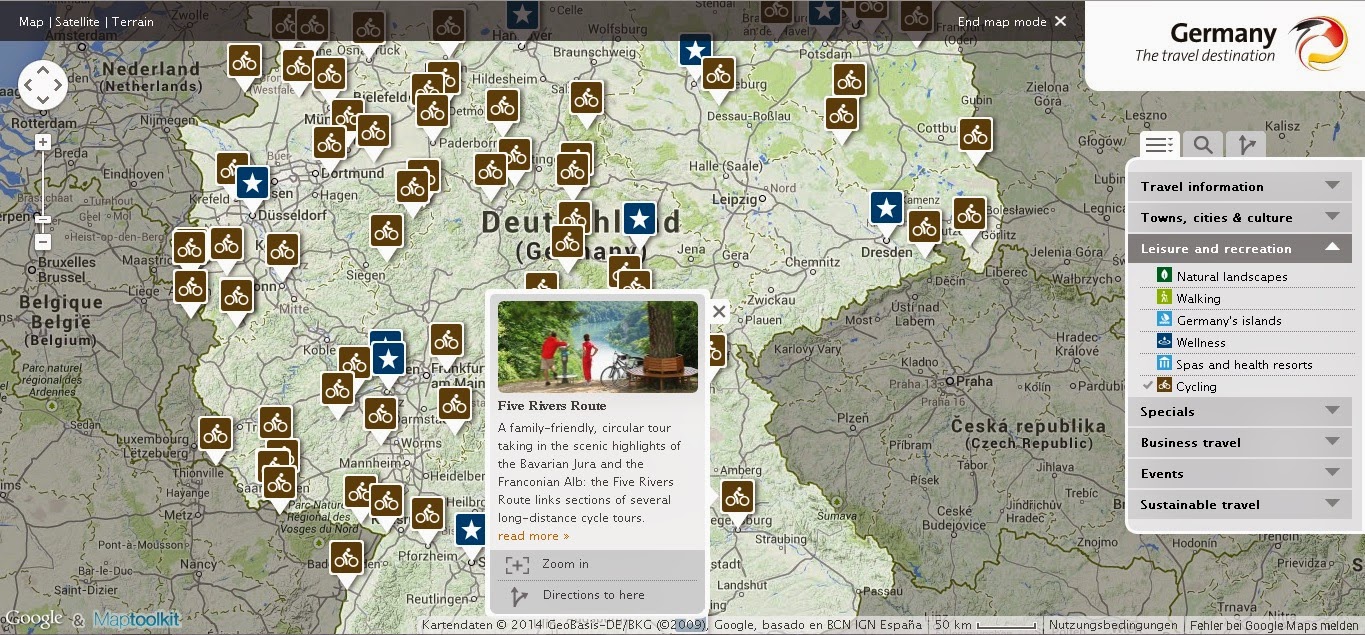
Do not try to look for German tourist sites like this. You can click on the map on the right and it will open the map you see below. I think it only shows the circular bike tours. I am not interested in any of that. The only time I cycle and end up on the same spot is when I'm lost. It never happens deliberately.

I have noticed that it doesn't show neither the Naabtalradweg, nor Donauradweg. The Five Rivers route is the one we need though.
In stead of the tourist website, I use this website. You do not have to know German the use it the way I do. Just follow the instructions below the screenshots.
After opening the link to ADFC, you should hover over Regensburg (#67). If the corrects route lights up, you can click it and another window opens.

Route 67 consists of 3 paths along a river. You'd have to look at all three of them to see if the bicycle lane is nearby your estimation of the route.

A new page opens with details of the cycle lane. Now click on 'Sehenswert' (points of interest) to see which POI's this bicycle route passes . The cities are always mentioned there.
You can see some familiar cities on the list of the Fünf-Flüsse-Radweg ("Five Rivers Route"), like Regensburg (destination), Kallmünz (look on the last google map I've posted) and ofcourse Amberg.

You can take the bicycle lane from Amberg to Regensburg.


Other Related Keywords:


Wernberg, unterköblitz, Richt, ettmannsdorf, Krondorf, Schwandorf, bike lane, Schwarzenfeld, Irrenlohe, Schwarzenbach, Stulln, luhe, wildenau, rothenstadt, naabtalradweg, naabtalradfahrweg, naabtalfahrradweg, oberköblitz